Monday, September 4, 2017

Happy Anniversary!

Day 18: Avalon Acreage
Distance traveled: 315.9 km
Total distance: 6,871 km - a personal record for one trip
Maximum speed: 132  kph
Moving average:103 kph
Temperature range: 14.2 - 19.8 C

The morning of our last day, we were treated to a breakfast of waffles and home made Evans cherry sauce, courtesy of my sister. Carol and I have discussed cherries are great length this year, since my own cherry trees (or at least, one of them) have turned quite prolific and Carol is a master gardener, so I have been anxious to share my good fortune with her. She managed to secure some cherries - just enough to make a modest sized batch of sauce - so we are really privileged to get included.

The last day of riding was was a total slab ride: all the way on Highway 2 north from Calgary. Despite it being the middle day of a long weekend, the traffic was busier than I anticipated. Highway 2 is always busy but I had assumed it would be less busy; it was not. In fact, it was a bit of a battle as vehicle traffic on that road is always traveling at a wide variety of speeds -anything from 15 km under the speed limit to generally about 25 km over the speed limit. There are frequently accidents on this road, yesterday included, and I am sure it is because traffic is moving at so many different speeds.
Retrieving extra layers from the top case.

We were really lucky to not have rain. After being away as long as we have, to have a total of about five minutes of rain and when we did, it was actually welcome relief, it was anticlimactic to have the threat of rain for our last our last day. The sky was a heavy grey when we left my sister's place and as a precaution, I put the rain cover on my tank bag so that if it did rain, I would not have to pull over to cover it. We will tolerate some rain on us but because the tank bank is where we keep all the electronics, I don't want to risk it. I had thought about putting our rain suits at the top of the pile in the top case but that would have meant rearranging everything back there but didn't want to delay any further our departure. What we did end up doing was stopping near Innisfail to put on an extra layer as it was cold for riding. We had dragged our heated vests around for the entire trip never once thinking they were something to use but we did end up breaking them out for the last two hours. I didn't bother to turn mine on, I just needed to have something else over my t-shirt and covering my neck. Nan had hers on Warp 9.

As hard as it was for Nan, we stopped in Devon to get some dinner groceries. The last day of a trip is always about getting back to the animals and to be fifteen minutes from home and to make a stop is painful for her. However, we had no idea what was in the house plus, it being our 29th wedding anniversary (Nan tells me that the modern gift for 29 is "furniture") I had plans for a nice dinner.


There is no greeting like a dog greeting.
Of course, the first order of business is to greet the animals. This almost makes going away worthwhile all on its own! Out cat Obi is little different: he is just happy someone is home to let him outside but after a couple of hours, when the commotion with the dogs has died down, he gets to have us all to himself and is incredibly demonstrative and affectionate... for three days.


When we had pulled the stuff off the bike, made a few calls and responded to some messages, we were able to celebrate our anniversary. We relaxed for a couple of hours and had a nice bottle of Champagne, then I cooked dinner for Nan. I did beef tenderloin steaks with a red wine
reduction, garlic mashed potatoes (skin on), glazed carrots and broiled asparagus. This was paired with a great bottle of Australian Shiraz called Ebeneezer, 2007 vintage.  For dessert, being on the cherry theme, I baked a small cherry pie with cherries from our own yard. As you can see, the top crust is obviously the map of our route.
Squiggle cherry pie.


This was a great trip. We saw some amazing scenery, met great people, experienced squiggles like no other and of course, witnessed one of Mother Nature's most spectacular shows. However, a ride like this would mean much less if I didn't have a great riding partner in Nan. We had way more fun than I anticipated and that might be because we were almost constantly bombarded with new and interesting scenery and riding in exciting terrain. I am always meeting people who are commenting on how lucky I am to have a wife that rides with me. Thanks, Sweetie; you are AWESOME!

And, as the parting shot, I have a few more eclipse pictures for you; this is, after all, the eclipse squiggle tour. A long time friend of mine who now lives in B.C. with his wife flew their plane to take eclipse pictures from the sky. In particular, one shot is of the "diamond ring" effect, which you may recall from a discussion in an earlier blog post. Thanks to Deb Ceravolo for these stunning pictures.


A great perspective on a rare phenomenon: at the moment of totality, seeing 360 degrees of "dusk".

The "diamond ring" effect.


Solar prominences. 


Nan took 98% of the pictures on this blog.

Sunday, September 3, 2017

Deja Vue All Over Again

Day 17: Back at my sister's place, in Calgary, Alberta
Distance traveled: 305.5 km
Cumulative distance: 6,556 km
Maximum speed: 133 kph
Moving average: 70 kph
Temperature range: 23.8 - 33.8 C

With a short day, there was no real urgency to get going. We got up at 8:00 and I said to Nan that I bet it would be 10:00 before we rolled out of the campground and that was the exact time we left. It was a beautiful morning, already getting warm and we lamented that we were not staying for a few days. However, we are anxious to get home.

We discussed whether we would get gas in Waterton or Pincher Creek; the latter would have meant we would be depending on the fumes in the tank so opted for Waterton. The town was jam-packed with tourists; people walking around, seeing all the sights, spending all their money. While I filled up with gas, Nan went to scout out lattes and some tourists walked by me and photographed the bike. At first I figured they were taking pictures of the organ transplant bag but I realized their angle would not have allowed for it; the were taking pictures of the load on the bike.
The harvest going on at Pincher Creek


We figured since we were not in a real hurry, we could relax a little in Waterton and have breakfast there. Nan had the lattes secured but she had chosen a breakfast place that was a little bit different: Wieners of Waterton. It is a hot dog place. I was not keen on a hot dog for breakfast however, I got out-voted, so we both ordered a "breakfast dog" which, as it turned out, was a sausage with scrambled eggs on a big, in house made bun. I asked for guidance on the "fixins" and was recommended "special sauce" (those words together always make me worry a little; just like "mystery meat"), ginger carrots and onions. I added banana peppers AND IT WAS OUTSTANDING. We sat outside on the collection of picnic tables thoroughly enjoying our discovery, the weather, the view, then the young son Jedd (well, young to us - a grown man with a career) of a good friend of ours walked by. He was in Waterton with some friends for a wedding, though they all seemed quite relaxed about how long they had to get ready. They were all looking for a bite but they had a WHOLE HOUR to go to get ready and make their way to the church. Kids. The gal in their group knew better and took off.

For the ride to Calgary, we retraced our earlier steps of Highway 22. It is always scenic and much more enjoyable than the slab ride of Highway 2. However, it is also generally sporting a generous cross wind. We had spent all of the previous day fighting a cross wind and then we again on this day it was starting to get a little old. Plus, it was hot early so it was really drying. I am sure that we will end up looking like prunes.
We stopped for a little rest in Turner Valley. Even though we were close, we had to get off the bike for a few minutes, so we laid down on the grass in a public park.

In Calgary, the GPS had taken us a way into town that had us pitted against some horrendous traffic along McLeod Trail. This was stop and go traffic of the worst order, made extra bad by the fact that it was about 33 degrees. It took us nearly 25 minutes to travel less than one kilometre so we found a way off, did a big loop to get onto Glenmore and dodge the traffic. However, we were just pouring with sweat and quite beat up from the heat and wind of the day so when we stopped at the little liquor store in my sister's neighbourhood, we were so relieved to get into some air conditioning. On the way to my sister's, Nan was hugging the chilled beer for relief.

My sister Carol always looks after her wee, baby brother. This night was no exception as she had prepared a chilled watermelon soup, some chicken satay which thankfully, I did not have to cook(!) a salad of greens from her impressive garden and cucumber slices. Then, there was the cake. When we had started out on the trip, she had made a rhubarb pie with an impression of a motorcycle poked into the top of the pie. THIS time, she had a ginger cake with a burgundy-coloured ST1100 on the top, with a wine-gum total eclipse at the top. My niece Anna and her boyfriend Jeremy were over, and Jeremy and I each had two piece.
DEFINITELY an ST1100.

Saturday, September 2, 2017

The Air is Fresh Here


Day 16: Belly River Campground, Waterton, Alberta
Distance traveled: 486.7 km
Cumulative distance: 6,250 km
Maximum speed: 130 kph
Moving average: 87 kph
Temperature range: 5.8 - 27.6 C (this after waking up to 1.2 degrees)

The campground was full over night. Only hours earlier, I had been thinking to myself that it would have been possible to do this trip, with the exception of the eclipse nights, without any reservations. We didn't have a reservation at the Many Pines Campground but we had the good fortune to get there early enough to snap up one of the last of the tent sites.  We still might have been able to get away without reservations but it may have added some stress.

We were away in reasonably good time; it was so cold that we needed to layer up and we went about tearing down the camp with business-like focus. It has typically taken us an hour and a half every morning to get up, take down all the gear, have a little bite and load the bike. This morning was no different but we did make a point of getting up a little earlier, so we were actually on the road about 8:40 a.m. For five minutes. It was a six km ride into Niemont, where we had gone the night before to get a few provisions for dinner from the lone store there. We were obliged to take our garbage from the campground with us since they had no receptacles there so we were looking for a place to dump our garbage. Turns out there was a big garbage can outside the store in Niemont so we opted to stop there and since we were stopped, get a coffee. When we walked into the place there were three guys sitting around just shooting the breeze with the owner. Idle chit-chat, I would say. The coffee was good and strong, so it was a great way to start the day. For the guys sitting around - remember this is before 9:00 a.m. - they were dumping liberal doses of brandy into their cups. I said, "what are you guys, Fresh Air Inspectors?" This was the term an old friend of mine had for people that would just come and hang out in his store with nothing better to do.  They were in fact, helpful to us because they were pretty knowledgeable about Montana roads we planned to travel and which were gravel and how bad the smoke had been the day before when one of the guys had driven that way. One of the guys, who had retired when he was 55, was planning on heading up to Jasper for a vacation. He was a motorcycler, too, but liked to ride adventure bikes.

We were soon out of the park and on the flat lands, riding into smoke. We discussed whether we would stick with our original plan about riding along the edge of the mountains or straight up Hwy 89. Staying on 89 would shave 30 or more km from the day but the ride would be much less interesting. The smoke was coming in thick from a couple of fires in Glacier Park but we opted for the route closer to the mountains, anyway.

It turned out that the smoke was bad only in a few places and at other times, the air was pretty clear. Also, we knocked off the last of the trips' squiggles, which was in the final 50 km before crossing into Canada. It seems the U.S. government couldn't be bothered putting in a straight road to the Canadian border or even, for that matter, properly maintaining the road they did put in since it was a total piece of, well, crap. Huge potholes, poorly patched other abrasions - it was almost a safety hazard. The good news is that the border crossing was not busy, which we had thought about beforehand, it being the Friday of a long weekend.

Belly River Campground is a camping destination we have been to four or five times in the past. It really is a nice spot; the tent sites are large, generally private and well-treed, there are some nice views of the peaks in Montana across the border and there is a great, clean, river flowing by that we always like to visit for a swim when we camp there. And, the place has some emotional attachment to us because some ashes of our first two dogs, Mahaba and Kalinda are scattered there.

Despite being tired from the day - we had been fighting a strong crosswind all day - and that we had enough emergency provisions on board that we could have cooked what we had and that would have been fine, we opted to ride the 20-odd km into town and get water, since there is no potable water at the campground and some food for the evening. On a lark, in the one-room grocery store, we bought ground beef, an onion, taco shclls and seasoning and cheddar cheese and made ourselves tacos and threw on a bagged salad to balance the meal. Oh, and a half sack of beer. Nan had to perch all this precariously on her lap for the ride back to the campground.

The swimming spot at Belly River.

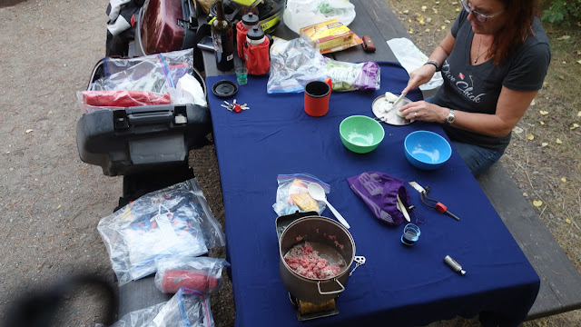
Cooking tacos

Friday, September 1, 2017

Bearstooth Pass makes Chief Joseph look like Pocahontas

Pine Lakes Campground, near Niehart, Lewis and Clark National Forest
Distance traveled: 449.8 km
Cumulative distance: 5,764 km
Maximum speed: 80 kph
Moving average: 66 kph
Temperature range: 10.6 – 31.0 C

Don’t get me wrong: Chief Joseph was a spectacular ride. Scenic with a ton of squiggles, it doesn’t get much better than that. Plus, what I really loved was at Dead Indian Pass, being able to look back on the valley and seeing the road up to the pass.

Yesterday when we had stopped for lunch, we had met a couple from Minnesota towing their Harley. They had observed that Chief Joseph was a great ride but should be done before the Bearstooth; today I learned why. At the time, I was thinking to myself that Joseph is a pretty great ride so I will reserve judgement until I had experienced both.

As we were setting up this morning, Nan asked me how long it would be before we hit the squiggles. I said, “about two minutes”. As it turned out, I was out by about a minute and a half. We were immediately into the squiggles and these were squiggles like no other. It was relentless hair-pin turns for 25 km up to the pass, which at an elevation of almost 11,000 feet, I am sure is a record for altitude for us on the bike. The pavement was new and good, though there was the odd rock that had fallen of the side of the mountain or spun out from a gravel turn-out. However, for the most part, it was excellent roadwork.

At the summit, we met two guys from Tucson, Arizona, Rod and Jerry, out for a three week ride, both on Honda ST1100s, like our bike. They both lamented that they were without their wives, and looked on with envy that Nan was riding with me, promising that the pictures they were taking was going to be fodder for action when they got home. That might not be the tactic, fellas; maybe it would be better if the six of us just met up somewhere camping and Nan could tell your gals how fun it is to be on the bike.

There is just something about ST riders, which might explain why there is an ST rider’s club but they are always friendly, chatty people. The bike is out of production but they last forever. Rod was riding a 1991 and Jerry I think said his was a 2001 so whenever we see one on the road, it’s always “hey, how are ya!”.  

We also met two mountain goats, a mom and kid, I presume. I think the mom was somebody’s pet because she was wearing a collar. The kid was a little more skittish but both were relatively comfortable with lots of people around taking their picture. It was a great setting; depending on the perspective, I got lots of shots of them with Nan in the background, the bike in the back ground and of course, the alpine in the background. I just didn’t think I could subject you to that many mountain goat pictures.

There were also tons of other bikes at the top and even though it was early in the morning, there was lots of traffic both directions. The significance of this is that the highway has been closed from 8:00 p.m. till 8:00 a.m. for construction, so people must have been waiting at the gate in order to be at the summit relatively early.

Later in the afternoon, we were looking for a campground in Lewis and Clark National Forest. I had planned on a campground on the southern end of the park but when we were arriving, we made up our minds that if it wasn’t busy, indicating that not too many people were trying to camp in the park, we would push on to the next campground, only 16 km further on. When we got there, we discovered that the campground was closed due to some trees that were unhealthy and in danger of falling down. What we learned later was that the campground had been closed since last fall when a tree came down and nearly onto some campers in their tent. Though I hadn’t planned on two alternative campgrounds, my recollection from planning the trip was that there was more campgrounds further on and sure enough, about another 15 km we found one. This was about 4:45 p.m., and not a moment too soon. The campground has about 20 sites but because the former campground was closed, this one was a little busier. There was maybe four or five available sites when we pulled in and it only took about fifteen minutes for the place to be filled.


As it happens, we are near the town of Niehart, a mere six kilometres away. We didn’t know what, if anything would be there but we set up camp then jumped back on the bike to get a few supplies hopefully and maybe some cold beer. 


Thursday, August 31, 2017

At the foot of the Bear's Tooth

Day 14: Greenough Lake Campground, near Red Lodge, Montana
Distance traveled: 355.7 km
Cumulative Distance: 5,314
Maximum speed: 129 kph
Moving average: 80 kph
Temperature range: 20.2 - 34.0 C

Due to road construction at the edge of Sheridan, we, i.e. Garmin, got a little confused as we tried to find our way out of town. Some old roads no longer exist and new ones were being created, so that the GPS thought we were driving “off road”. This makes it very challenging to find a route since it is always searching for the nearest road to get us to our destination, assuming it is not an Interstate or gravel road. We did follow the directions though, and ended up on a small adventure as it has us on what appeared to us to be a private road belonging to a coal operation; there was a gate on the road but it was swinging open and the road was paved, sort of, or at least, had been at one time. We went through the gate and what remnants of pavement there were soon gave way to gravel, though it was small and on a hard packed surface, so was easy for the bike.  As we made our way along, getting closer to the coal operation, we were running alongside another road, this one paved and I thought if we could get on that, even if it meant going through the grass, it would be better but alas, there was a fence defending that road. As it turned out, there was another gate blocking our exit from the coal operation. Nan jumped off the bike to see if the lock was just “dummy locked” but it was indeed shackled and closed, so we ended up having to turn back the way we came.

This resulted in our having to take about ten kilometres of Interstate; not the end of the world – it was not busy, few trucks, 75 mph speed limit and no guard rail to block our view.

In short order, we were climbing switchbacks into the Big Horn National Forest, only at the north end as opposed to last week on our way to the Black Hills. Even though we had passed through a few towns on the way, we had resisted the temptation to stop for a bite having had a couple of coffees in the hotel room early and wanting to make some miles before taking a break, especially as we had had our little side trip. High, high up in the Big Horn, we came across the Arrowhead Lodge, not quite at Burgess Junction where Highway 14 heads south and 14a continues west.
The Arrowhead was a pleasant surprise to us because we were getting quite hungry, having been on the road for an hour and a half, and there was no reference to it in the Garmin. Actually, there was nothing listed for Burgess Junction, even though there were at least three lodges up there, gas and restaurants.

It was pretty quiet up there and we wondered if it was open but with school started in many parts of the country, it was full-on shoulder season at the lodge. As per usual, we had just missed the breakfast hour, which finished at 11:00 a.m. The building which houses the restaurant was built in the late 30s and had a ton of character and the usual charm of an out-of-the-way fishing and hunting lodge. Additions to the original building were more practical, and there were cabins and a larger complex associated with the main dining area. The whole place actually looked quite large and I would think it probably had 40 rooms, so would be a pretty busy place in the summer.

What was really great was that the food was really authentic, home made and outstanding. Nan had a burger but the patty was hand made and grilled. I had brisket that had been rubbed and smoked by the cook as well as house made cole slaw and beef soup. It was all quite exceptional and for anybody heading this way to the Black Hills, I urge you to stop here and eat.

It was a seemingly long ride across the basin from the Big Horn National Forest to the Bear’s Tooth National Forest – hot and boring – but when we got across, things immediately picked up. We went through a few little towns, passed by the tragic Smith Coal Mine, where 72 coal miners had lost their lives in a 1943 mine explosion and into Red Lodge, a picturesque, touristy ski town not far from where we were camping for the night.

We were surprised as soon as we rode into town as all the buildings on the main street had flags hanging form them and the street lamps had beautiful hanging baskets of colourful flowers. The town is old and many buildings were brick or stone from the mining days and it all looked very inviting. Nan identified several stgores from the bike that she thought she might like to visit, however, that rarely happens on these trips. One place we did see though, was Bone Daddy’s Custom Cycle; earlier in the day, we had met a couple of motorcyclers and the gal was wearing a cool shirt from Bone Daddy’s. We decided that we would go in and check out what else they had.

It is not a cycle shop but a clothing shop. There were two outrageous gals in there looking totally bored and disinterested. It wasn’t even clear if they were working there or just hanging out; neither of them even got out of their seats from behind the counter when we walked into the place. However, we liked the clothing and we each picked something out for ourselves. Nan bought a gift for a friend and then decided she would keep it for herself.


We grabbed our usual deli dinner from the IGA and treated ourselves to a nice bottle of wine, later congratulating ourselves for eating relatively healthy, all things considered. On the way to the campground, we see signs that say “food storage required” and a picture of a bear. The local high school football team is The Grizzlies. We are heading over the Bear’s Tooth Pass tomorrow. Who do you think was getting anxious about bears? The camp host told me that there had been no bears around for the entire summer and despite the fact that our campground reservation had snagged us the premier tent site, right next to the river, it did not have a bear-proof food storage bin as did most of the other campsites, so we ended up moving. 

Ed note: having lunch at the edge of Yellowstone. Internet too slow for pictures. Later.


Wednesday, August 30, 2017

Custer's Last Stand

Day 13: Sheridan, Wyoming
Distance traveled: 299.3 km
Cumulative distance: 4,958 km
Maximum speed: 135 kph
Moving average: 89 kph
Temperature range: 22.0 - 36.0 C

We rode up to Crow Agency not on the Interstate, to the area of Custer's Last Stand. It is really quite an amazing memorial and as soon as we arrived, we listened to a brief description of the battle that ensued June 25, 1876. The presentation was impressively balanced with no judgments being made for or against either side.

Lt. Col. Custer had been charged with the task of transplanting Lakota Sioux and Cheyenne to the Cheyenne Reservation in Dakota territory, though for some reason, the Indians did not want to be moved. In their minds, they were standing up for their way of life and if they ended up being put on a reservation, the life they knew would be lost, so there would be no reason to live. As such, they fought to protect their way of life or die trying.

The 7th Cavalry was there to enforce Custer's orders but were vastly outnumbered, as five tribes had banded together to join the fight. Estimates that the Indian encampments along the Little Big Horn River below was 6,000 to 8,000 people, of which 1,500 to 2,000 were warriors. In those days, the Native Americans had firearms from trading or capture, though they still used bows and arrows. The 7th Cavalry numbered about 600 however, Custer had split them into three battalions, ordering one to scout the bluffs to the south, the other to cross the river and attack the upper end of the encampment.

In all, 262 men from the army and civilians died on that day. It is not known how many Native Indians perished. In addition, many horses died, including dozens of Cavalry horses that were shot by Custer's men as they made their last stand on the hill; they were desperate for cover and the horses bodies were all they had.

Marble markers had been erected at the place where soldiers were believed to have fallen or killed, though it was recognized that it may be impractical to do this with any certainty. The last 28 troops on the hill fighting with Custer, after Custer had been killed, attempted to flee down the hill to a ravine and were killed there; markers were placed descending the hill but it cannot be determined with certainty whether they were killed as they ran down the hill or in the ravine. In addition, their remains have not been discovered.

The hill where Custer and his men made their last stand.
The trail to the basin, where towards the end of the battle on Last Stand Hill, a group of soldiers attempted to either flee to safety or attack.

Marble markers indicating where soldiers' remains were found and initially buried.

Where Custer's body was found.

Red granite markers indicating where known Indian warriors fell.
Lt. Sturgis, the son of General Sturgis.  There is a famous motorcycle town where a large rally is held named Sturgis.


From the ride between Sheridan and Crow Agency.


On the way back to Sheridan, we thought we would stop for something cool to drink, maybe a snack, at a tavern we spotted on the way up to Crow Agency. As we approached the place, it looked more closed than open; there were no cars, no lights, nothing to indicate there was anyone inside, and we sped right by. However, I thought we should at least pull on the door handle, so we turned around and Nan jumped off the bike. Sure enough, the place was open, and I was privy to one side of the conversation (Nan wearing her helmet with the communicator on) she had with the bartender.


Of course, no cars, no people; just the bartender. She was there all alone. The place was filled with various types of gaming machines, which the bartender, Veronica, explained to us was legal in Montana but illegal in Wyoming, so a big part of their business was for residents of Sheridan about 30 km away.

That's Veronica, preparing our snack.
We weren't drinking of course, but she was happy serving us soft drinks. Nan asked for ice tea, which turned out to be sun tea, but the last of it. Since we hadn't eaten, we thought we would order a snack and Veronica gave us a menu. We ordered Nacho Supreme, and I use that term lightly. Notwithstanding we didn't see any other employees, I just assumed there would be a kitchen with somebody in the back to make us something to eat. Wrong. Everything was behind the bar for the bartender to make anything a customer ordered to eat. This included a completely enclosed deep fryer in which she opened a small chute, dropped in her fries, and they came out the bottom about three minutes later.

For the nachos, she did everything on the bar right in front of us. She pulled out a package of tortilla chips and spread them out on a large Chinette plate a plastic container with beef chili, another plastic container with "cheese" sauce (what Americans call "American cheese", which isn't really cheese at all, though it does have an infinite shelf life), small pre-prepared containers of jalapeno peppers and sour cream, and opened up a can of black olives. I actually had to help her with this because she couldn't work the can opener. Everything was heated in the microwave.

Veronica was a former EMT but after ten years, felt she needed to get a away from it. She was chatty and asked lots of questions about Canada, the Canadian health system, the political system (three party vs two party) and had her own observations about the state of U.S. politics and Native Indian affairs (again, in the U.S. the term Indian is not considered disparaging; these were her words). I thought it was interesting that she had been to Mexico twice but never to Canada, even though she was only a couple of hours away from the border. She said she had friends that lived close to the border but had never been across; this is surprisingly common, I have found.

The Kirby Saloon, form outside.

When we got back to Sheridan, I was tasked with my husbandly duties, which was to tend to the laundry. Later, after getting all cleaned up, we went out for what I expect will be our last night out to a "nice" restaurant, since it is camping till Saturday. There is a chop house about three blocks away, so a pleasant walk, especially as the temperature had fallen to about 28. When we presented ourselves at the door, the manager asked us if we were celebrating anything and we both answered simultaneously, though, as always, Nan said "no" and I said "yes". My stock response is that we are celebrating our love for each other but in fact, our 29th wedding anniversary is on Sunday, so that is what I told her.  They made a big deal of it, comped one of our glasses of wine, and came by and took our picture and printed it at the restaurant for us to take as a souvenir.